For Parts 1 and 2, please scroll down......
Tuesday turned into our second long drive in a row. The trip had been planned to have light driving days mixed in there, but we still ended up with two fairly long ones. Even so, by 4:30 pm we had driven to the top of the highest mountain in the Wichitas in southwest Oklahoma.
The morning was a cloudy one, and again it was very warm. The temp would hit 91 F today, and the next day was to be similar. After that, a cold front would sweep through, so that when the more strenuous hiking began further west, we should have perfect weather. About an hour west of Springfield is Joplin, MO. Just off the last exit before Oklahoma is reached is a great area to pull off. There is hiking, Missouri's highest waterfall, and a nature centre we have yet to visit. Today as we passed the centre, two school buses were parked outside. That was enough to keep us away. I had brought a UV water bottle system with me, to be used mostly on the long climb to Jicarita Peak. Not wanting to carry a lot of water uphill, the bottle would be used along the way at springs and small lakes to keep me going. There is a spring not far from the nature centre near Joplin, and we visited today so I could use the bottle and drink some clean water. We filled up, then soon returned to the highway, heading west.

The water comes out of the rocks in wet years. This year it was coming out of the bottom of the rock, on the far right side of the little pool. It then flows out of the area, over a little waterfall, and into the nearby river.


I was able to fill my UV bottle at the little waterfall. I had fresh drinking water for the next day.
Once in Oklahoma, the main choice for drivers is the toll highway. It cost us $10 and two brief stops to pay to get from Missouri to the Lawton, OK area, where we would be hiking beginning late this afternoon. We gobbled mile after mile, stopping in Tulsa at Whole Foods for lunch and to pick up a few more supplies. Coffee somewhere else along the way, and then Deb suddenly spotted a real live mountain in the almost foggy distance. It was big enough to be impressive, too! Huzzah! The flatlanders had arrived somewhere that wasn't flat!
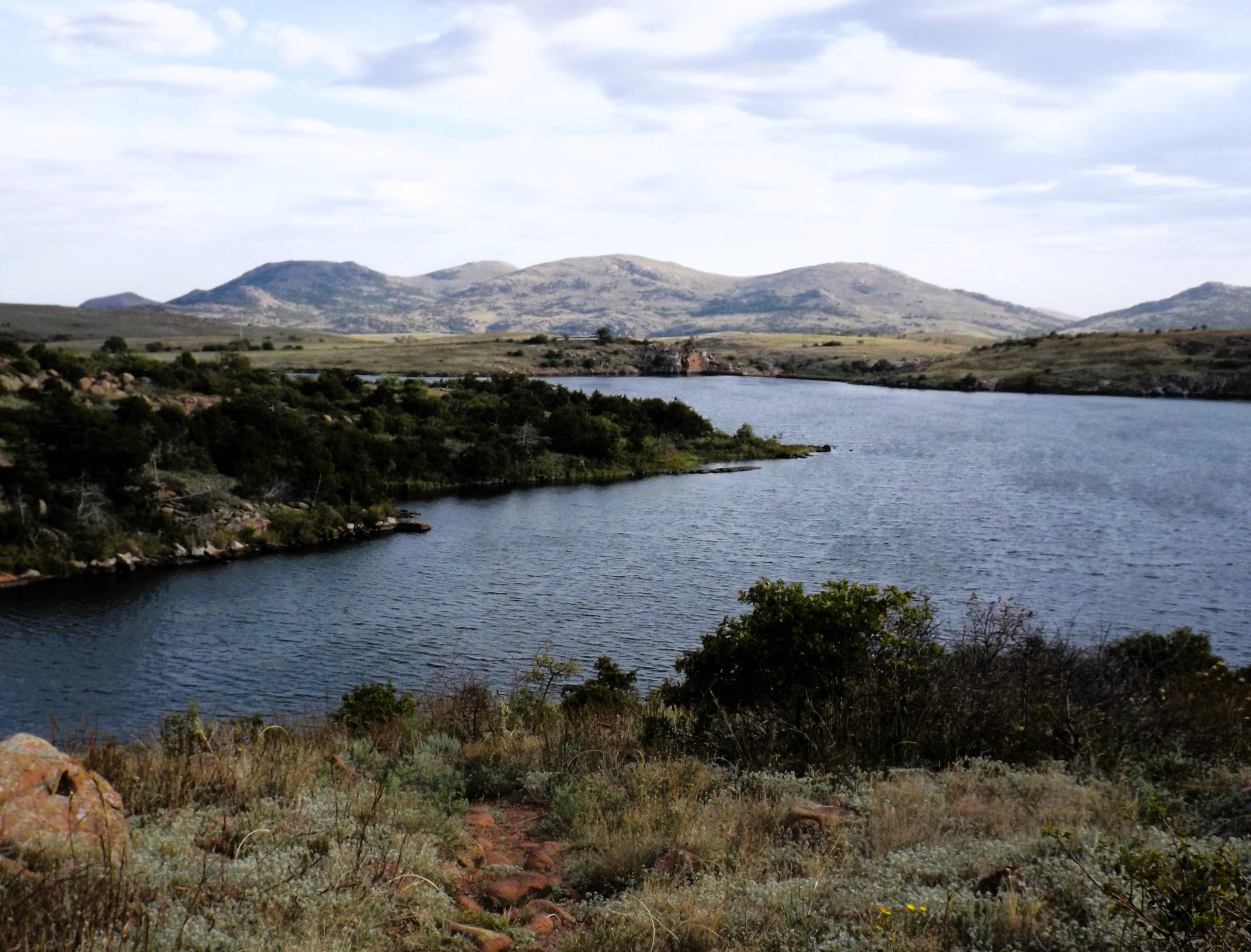
Mt. Scott is just within the boundary of the Wichita Mountains Wildlife Preserve, and a paved road leads to the top. We drove up at a leisurely pace, parking at the top. It was really windy, but the sky was clearing up. The mountain was filled with giant boulders and smaller ones. We were officially at 2464', just over 1,000' above the Great Plains beneath us. The area is saturated with man made lakes, mostly constructed by building dams in the 1930s by the CCC. Reaching a mountain top is always an exhilarating experience. We stayed up a while, then headed back down, in search of our first hike. Unbeknownst to us, that would be our highest elevation of the journey, and the upcoming very short hike would be the only one to be completed. Five weeks of intense training about to become irrelevant. Life is certainly an adventure. Since this is the only mountain we attained, I hereby post a lot of photos from it.

View east towards giant Lake Lawtonka.

View southeast towards the village of Medicine Park, on the right. We would enjoy a vegan dinner down there soon. It was humid and hazy.

Southeast end of Lake Lawtonka, again towards Medicine Park. Telephoto shot.

View south towards Lake Elmer Thomas.

Zoom shot of Lake Elmer Thomas, showing a small boat.

Looking southwest from Mt. Scott.

Looking west into the very rocky Wichita Mountains.
The one hike we completed was very short, about 0.4 miles each way, to a stone lookout tower (now closed to the public) overlooking a small lake, built in the 1930s by the CCC with left over stone from building a dam. This was it, folks. Our one hike in the mountains.

Deb did just fine on this trail, not even wearing her trail shoes or using her walking pole. Jed Johnson Tower looms ahead.

There is some fine walking to do in the area. Someday, maybe.

Deb does some boulder sitting at Jed Johnson Tower.

This was once a lookout tower for visitors.

Perhaps my best shot of the trip, looking towards Mt. Scott from our hike.
Next day we were up early; 6:30 am to be exact. It was very warm and humid already, with major storms on the way. We had plans to hike till about noon, then make a run for Amarillo, which would enable us to miss the incoming weather. It was a great plan. The visitor centre for the park opened at 9 am, so we waited around about ten minutes for it to open. I bought a tee shirt, a small guidebook, and a small foldout guide to local flora and fauna. If the hiking got too difficult, the plan was for Deb to stay in one area and look around, while I hiked.
We drove to our first hike of the day, beginning at a dam on Quanah Parker Lake. We had to do some serious stairs to get across the dam, where the trail began. We set out, walking slowly. Hiking boots and shoes were on, and we each had a pole. I walked a little bit ahead, scouting for the best route for Deb. All to no avail.

Early morning shot of Mt. Scott, with a cloud hat.

Bison and long horn cattle roam the plains within the park. This big fella was heading towards the road, so we moved on past him.

We had to cross this dam to reach our trail.

The last photo, taken just a minute or two before things crashed to a halt.
The trail was a mix of fine sand and rock, sometimes both together. It was at a slight incline that Deb fell. I was only a second away from her, but could not do anything. I turned to see her on the ground. At this point I knew that the hiking trip was done. Even if she wasn't hurt, there would be no more hiking on this journey. But she was hurt. At first she couldn't breathe, having the wind knocked out of her by her fall. Her foot had slipped on a sandy rock, and she landed hard on her left side, the same side as her cast. At first I thought she had hurt her already broken wrist. But after her breath came back she was wracked with pain (a level 10 out of 10, I am told). Worse yet was that we could not get her back on her feet. She was in too much pain.
It took several minutes and many attempts, but we finally got her back upright. There was no one else around at this time of day. And, as we were soon to find out, there was no cell service back here. Blocked by the mountains. So we were on our own. By the description of her pain, it sounded as if several ribs were cracked or broken, and were perhaps pressing on her lung. It was a very slow walk back to the car, which we could see in the distance. Then there were two flights of stairs to descend, and two to ascend. Once back at the car, the next problem was getting her into the seat. Everything hurt, from moving to breathing. Back to Lawton. First an urgent care clinic, but we were sent on to the local hospital from there. X-rays, a pain pill, and a diagnosis. Nothing broken, but she had bruised her lung quite badly. They also fixed up a nasty scrape on her left elbow. No one asked for any money. Two prescriptions were given, both filled at the hospital pharmacy. Cost was $11.
It was after 3 pm when she was discharged. She seemed comfortable enough in the car, so we decided to start the long drive home. The storms hit almost as we left, and followed us for two days. Continuous lightning, the heaviest rain I have ever seen (for hours on end). It was dark during daytime, and we drove on into the real darkness. I followed the lights of a transport just ahead, averaging about 75 mph in the rain. It was a crazy drive. We pulled off in Oklahoma City for 30 minutes, due to accidents and flooding. Back on the road, find another maniac truck driver to follow, and go until we couldn't sit any longer. Two nights motel (Joplin, then Lafayette), then home. We arrived 47 hours after leaving the hospital.
It took two weeks, but Deb's pain has finally decreased enough for her to do most normal things again without wincing. It should be all healed in another 2-4 weeks. Her cast will come off about then, too. We made it home with two bags of coffee and some beer. But we left a good deal of unfinished business behind us. Namely:
1) Explore the Wichita Mountains more deeply.
2) Visit Amarillo and explore Palo Duro Canyon.
3) Visit Carlsbad, NM, and hike the Texas highpoint (me, anyway) in Guadalupe National Park.
4) Hike another segment of the Crest Trail of the Manzano Mountains in NM.
5) Visit Albuquerque.
6) Hike Jicarita Peak in NM, one of the real big ones (me anyway)
7) Enjoy a leisurely drive home over several days, visiting Dodge City, KS; Lawrence, KS; Columbia, MO; and Indianapolis. Collect local craft beer and coffee along the way.
Will the unfinished business listed above ever get done? Stay tuned to my blogs to find out.
Update: As of August 30th 2024 the trip is back on for October. Intense training begins Sept. 6th.
Mapman Mike
No comments:
Post a Comment